25 h Module on Cartography - Technical Course on Ecotourism
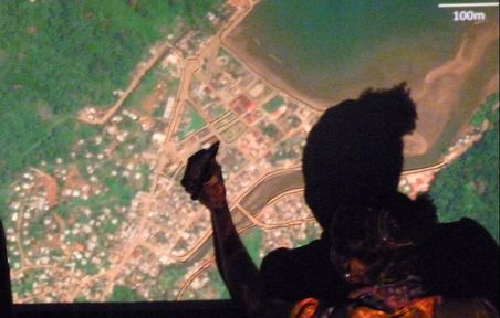 Using satellite imagery to draw a map of Sto. António city (Principe island) © GPPorriños
25-hour course on Cartography as part of a Technical Course on Ecotourism awarded by Instituto Superior de Administração e Linguas (Madeira), lectured in Principe island (July 2017)
During the classes, technical training was delivered on map reading, using elevation maps to plan routes, calculate distances in the map using the scale, orientation using the compass and mark coordinates from a GPS device in the map. The course used a participatory and practical approach, getting the students to use in practice the different aspects of maps reading
During the classes, technical training was delivered on map reading, using elevation maps to plan routes, calculate distances in the map using the scale, orientation using the compass and mark coordinates from a GPS device in the map. The course used a participatory and practical approach, getting the students to use in practice the different aspects of maps reading
Materials (in Portuguese)
24/07/2017 - Sessão 1 - Características dos mapas - ppt
25/07/2017 - Sessão 2 - Escala e relevo - ppt
26/07/2017 - Sessão 3 - Aula prática: escala e relevo - material
27/07/2017 - Sessão 4 - Sistemas de coordenadas - ppt - material
29/07/2017 - Sessão 5 - Aula prática: uso do GPS e orientação - material
31/07/2017 - Sessão 6 - Revisão - material
02/08/2017 - Teste